Sixty in 2013: Lassen Volcanic National Park, CA – On a Clear Day . . .
Leave a commentSeptember 16, 2013 by Deborah W. Trotter
If you’re a regular reader here, you’ll remember that several weeks ago, I posted a photograph of a fire lookout without identifying it. Today’s post reveals that it is on top of Mt. Harkness in Lassen National Park. If you hike to the top of the mountain during fire season, you will most likely be invited up into the lookout, occupied 24/7 by a person trained to spot wild fires.
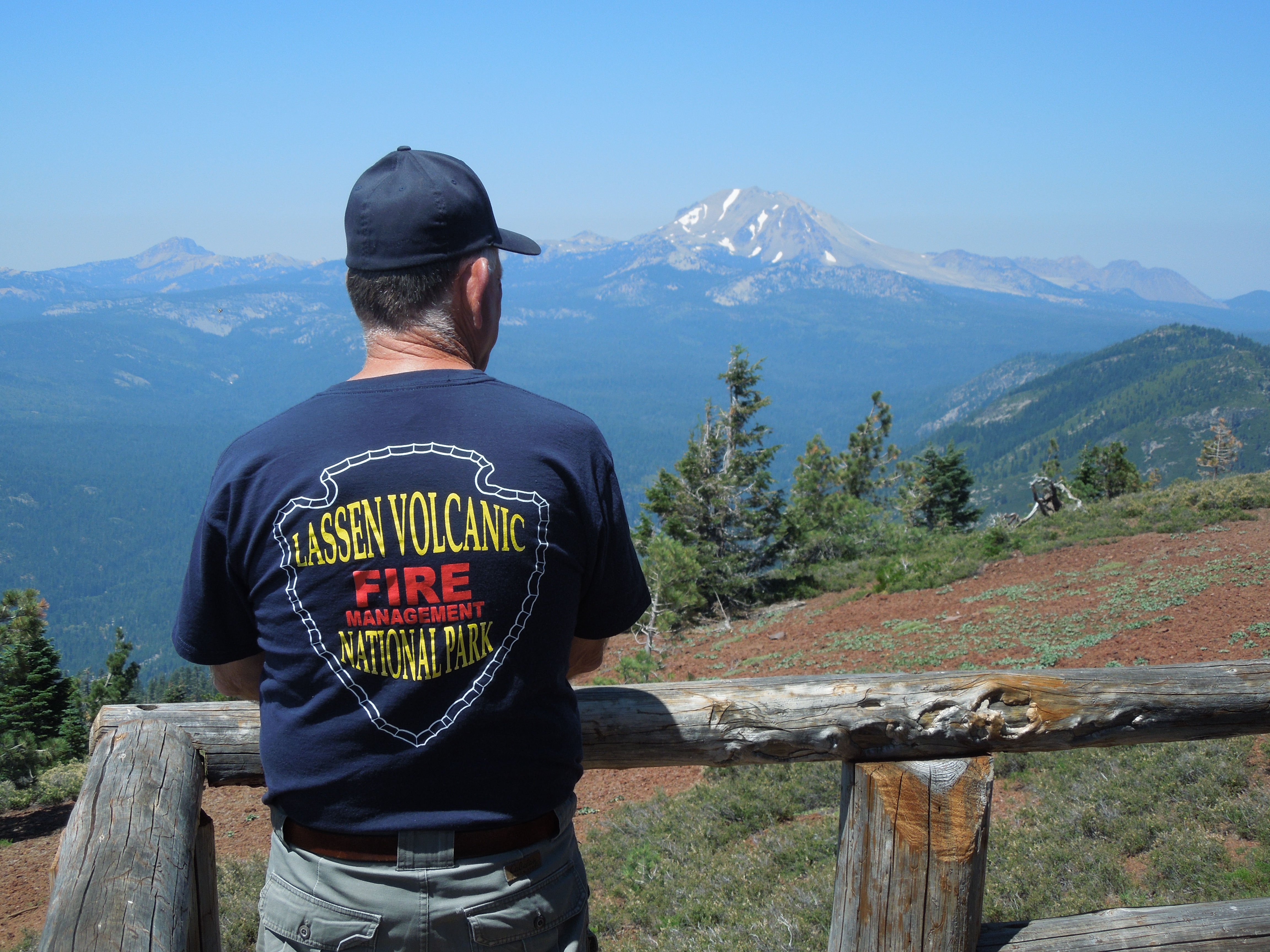
The view from the Mt. Harkness lookout is 360 degrees. On a clear day, you would be able to see much of Lassen Park, as well as the Sierras, the Coast Range, possibly Mt. Diablo to the south, and north past Mt. Shasta, as far as Mt. Ashland in Oregon, more than 150 miles away.

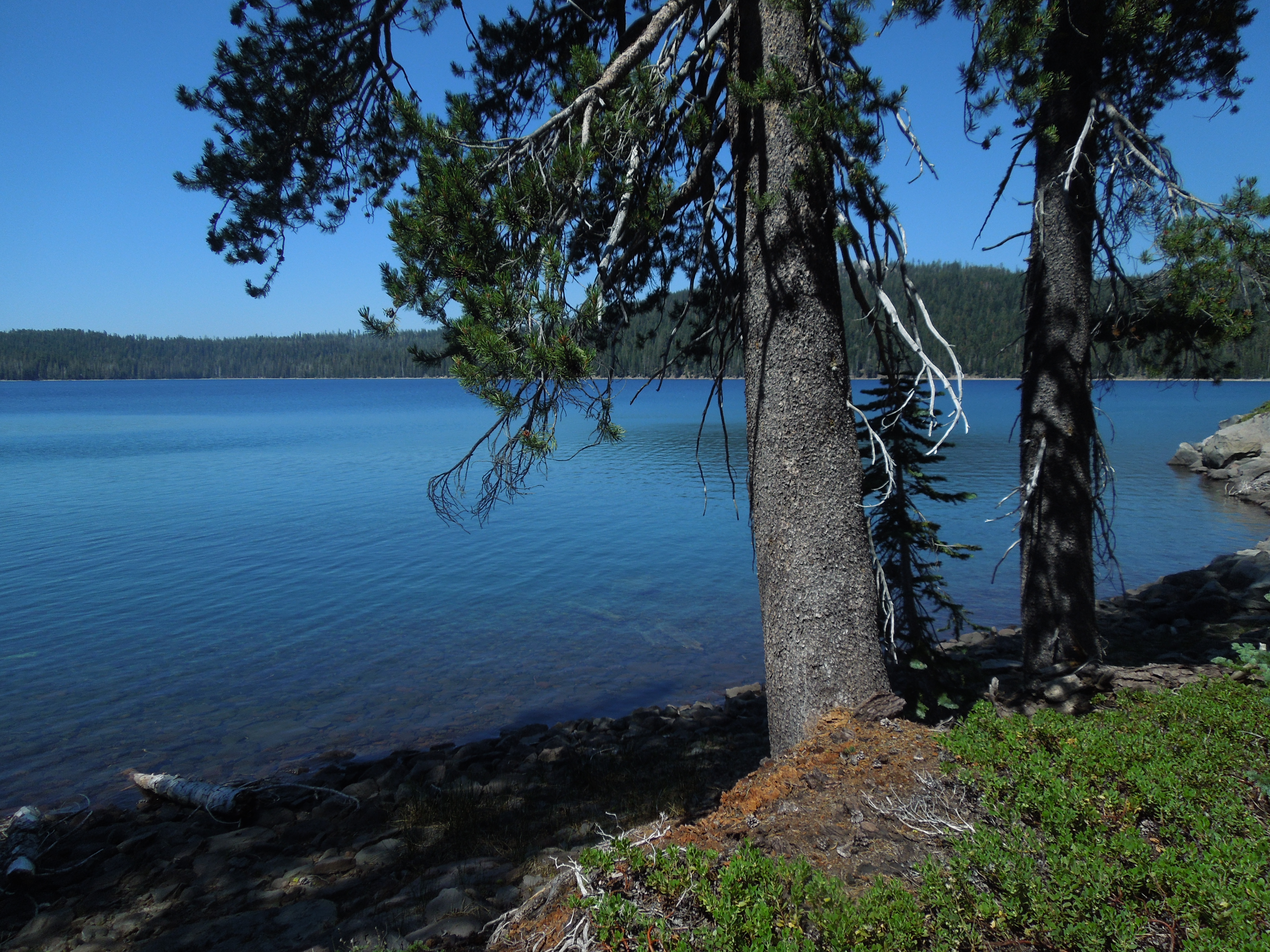
Juniper Lake from Mt. Harkness
On the day we visited in mid-July, visibility was hampered by smoky skies and midday brightness, so we have put this hike on our do again list. I can just imagine a top-of-the-world feeling on a crisp, late fall afternoon.
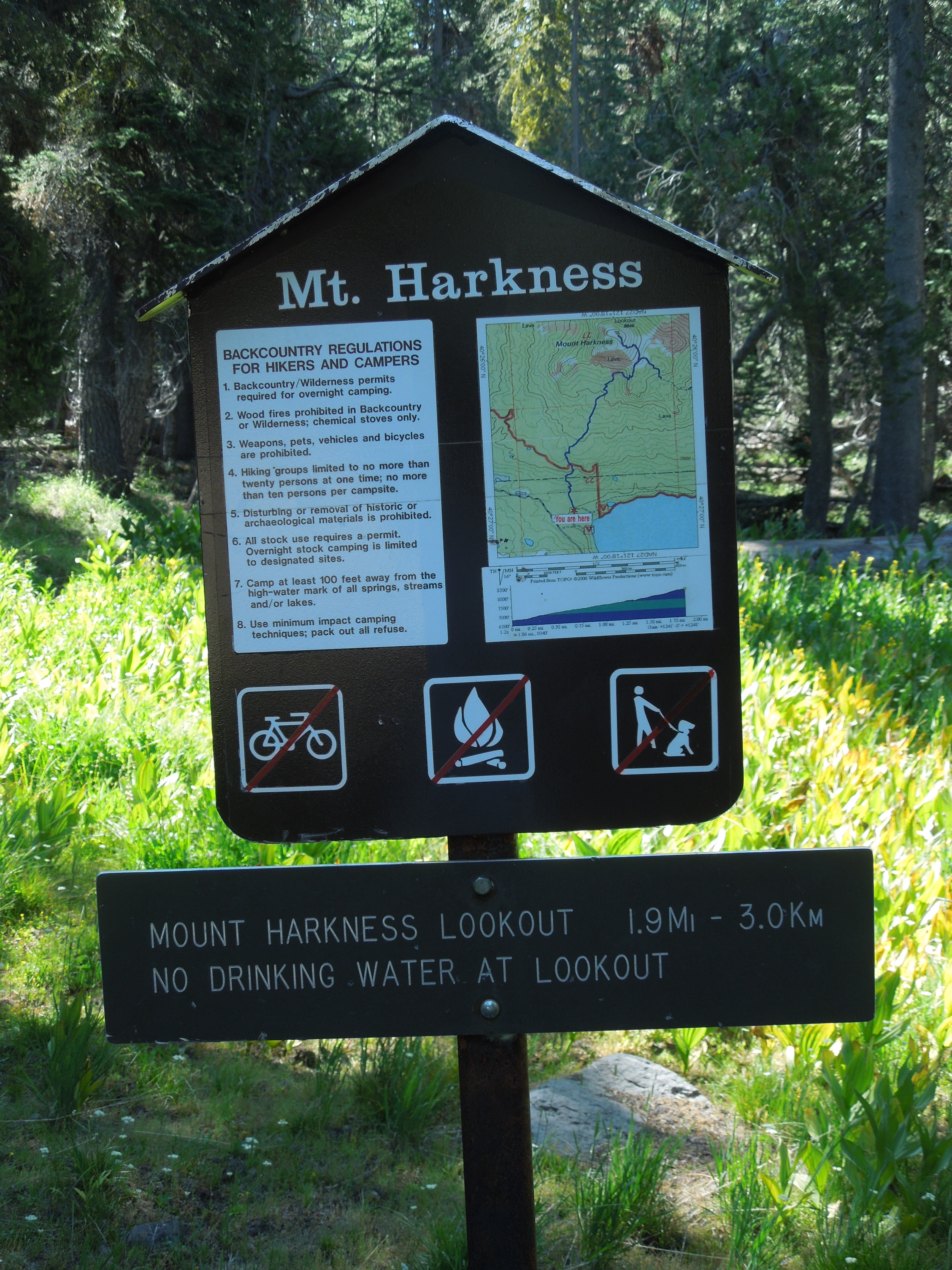
The trailhead for the hike to the top of Mt. Harkness is in the Juniper Lake campground, 13 miles from the town of Chester on a mostly unpaved road, rough and teeth-rattling. There is day use parking above the campground. The trail starts up gradually through meadow and forest, then climbs more steeply through an old forest with lots of snags and downed trees.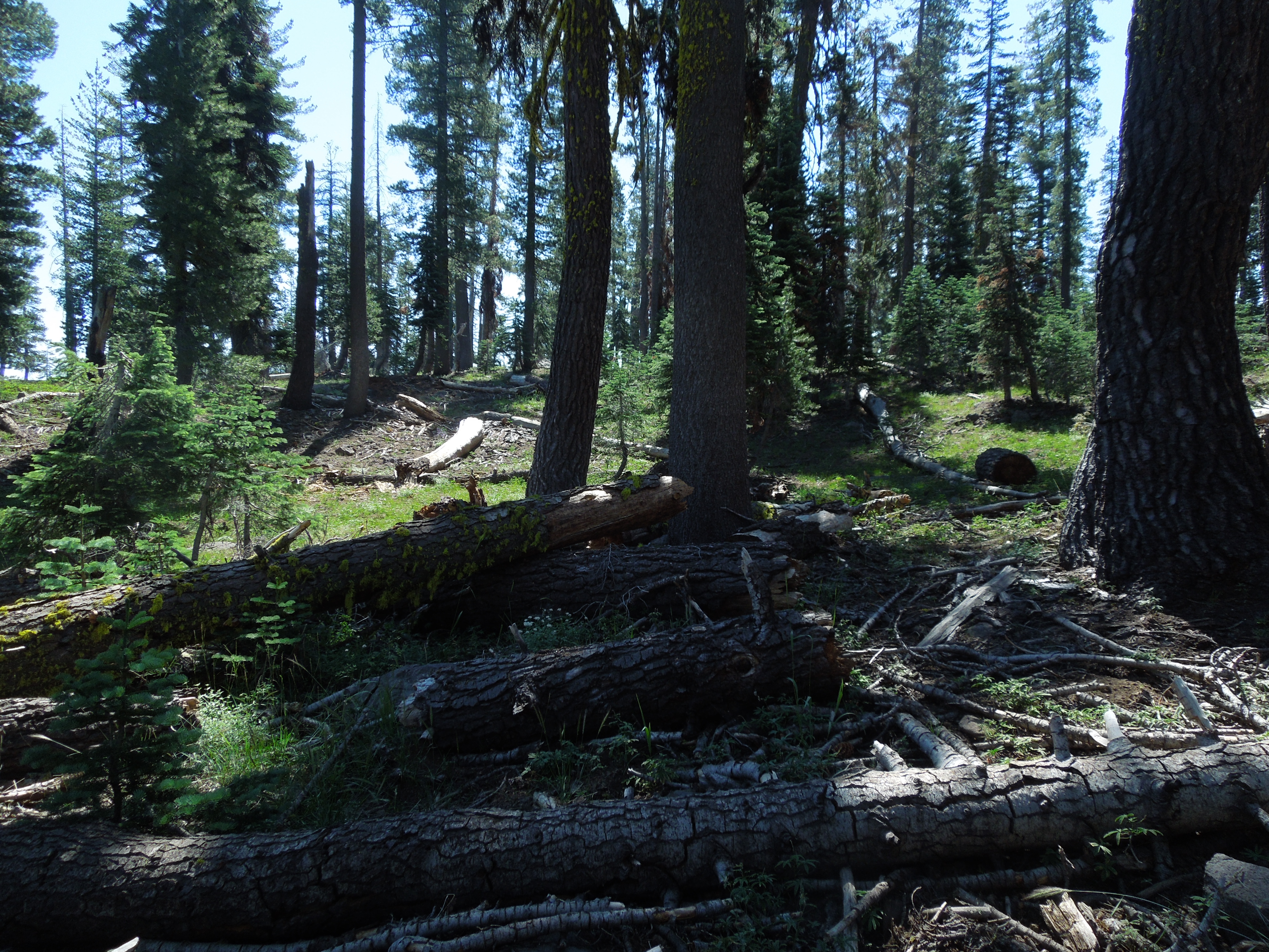 The day we were there, little butterflies were ubiquitous, at least five different species flitting from sun to shade and back again.
Soon Juniper Lake will be visible below, and as you continue up and begin to skirt the flanks of Mt. Harkness, you alternate being out in the open and in the trees. Occasionally, it is unclear where the trail goes, and the metal disk blazes on tree trunks will keep you on track. 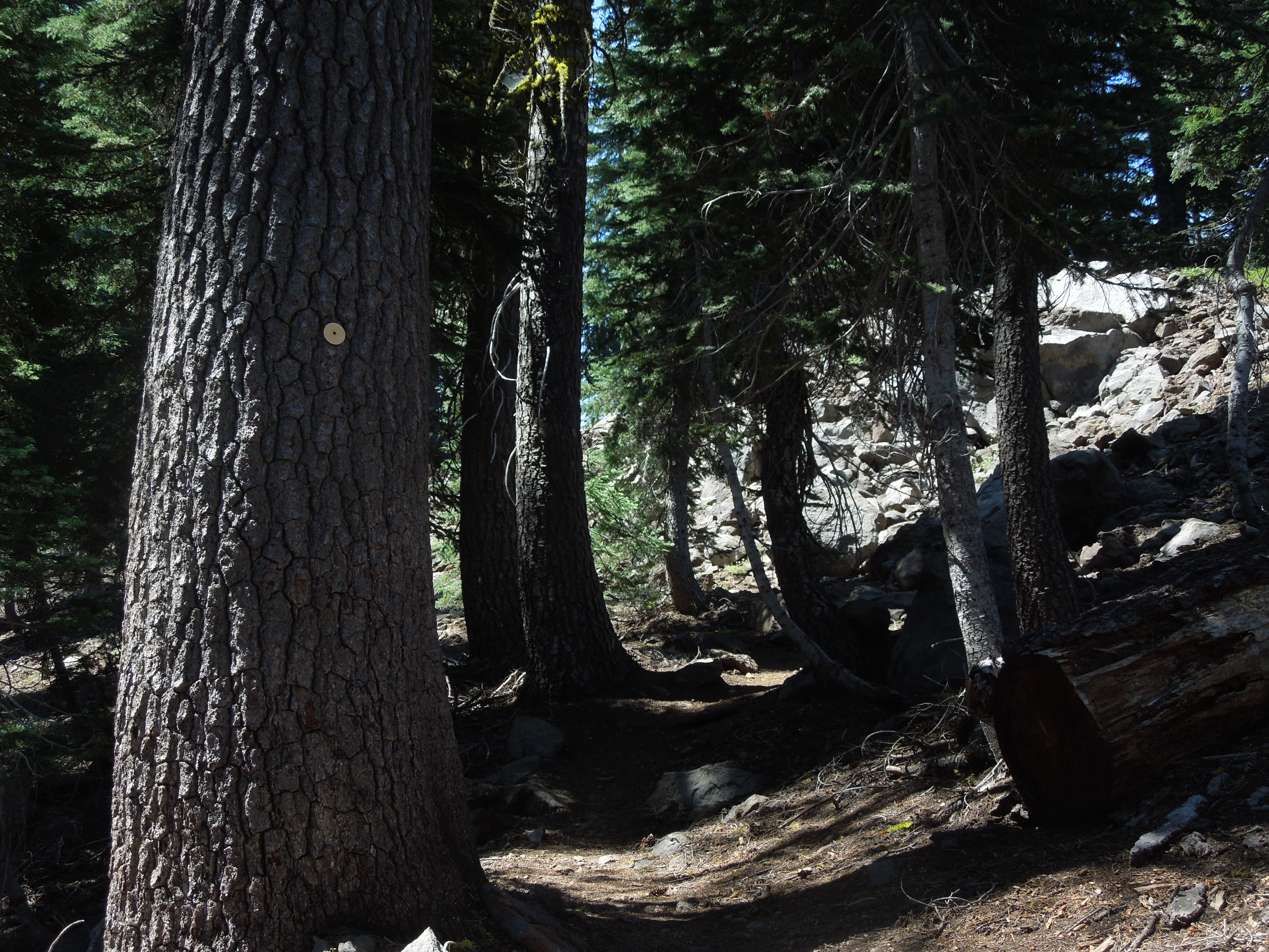
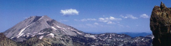
Eventually, you get above timber line and the view opens up of Mt. Lassen and Brokeoff and everything in between. 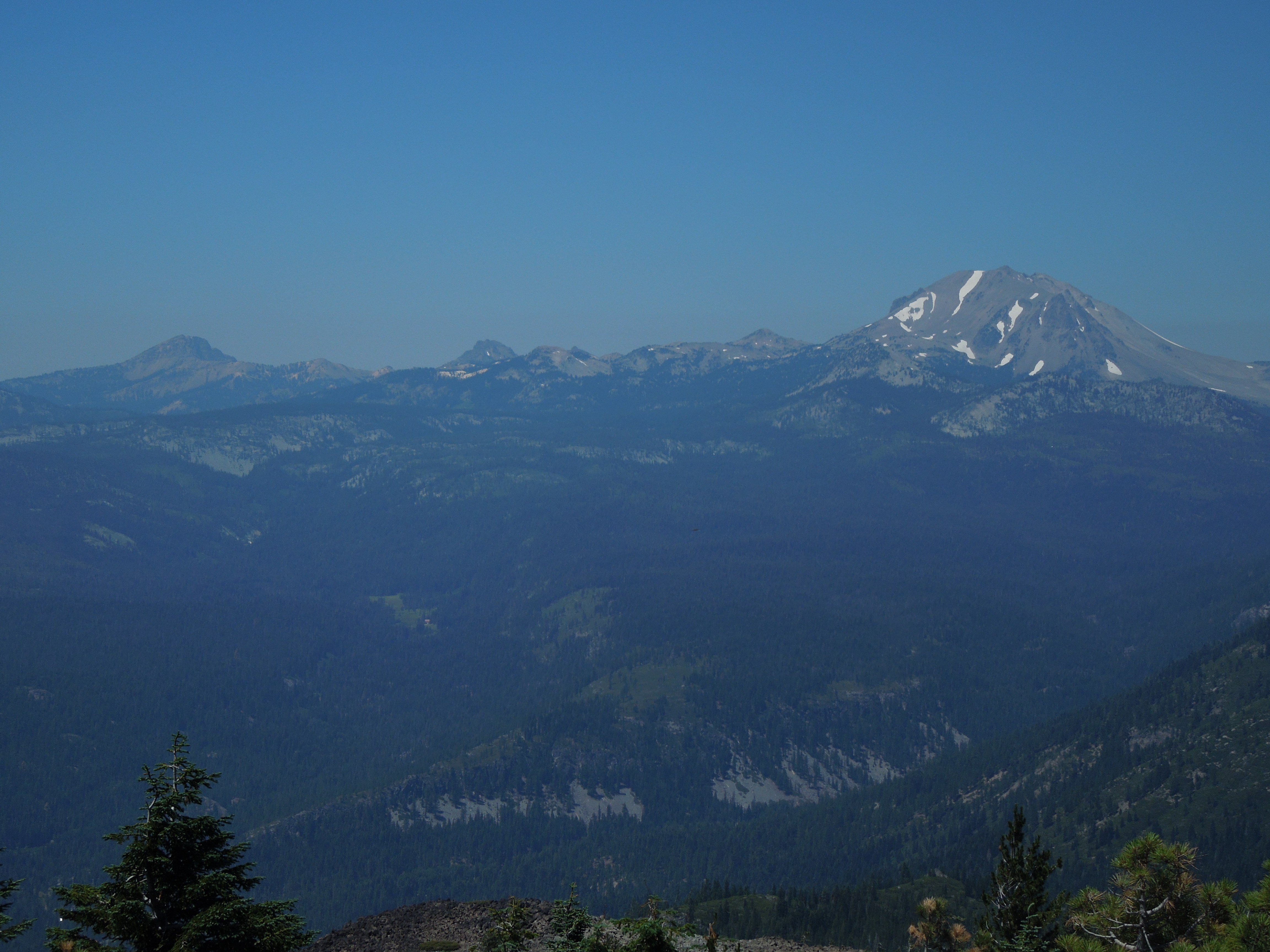
From that point, two long switchbacks through soft dirt and lupine meadows take you to the top of Mt. Harkness and the fire lookout.
The hike is 1.9 miles one way with an elevation gain of approximately 1,200 feet, from 6,792 feet at the lake to 8,048 feet at the top of the mountain. The return trip offers a choice of retracing your steps all the way on the main trail or taking the Juniper Lake loop, which we opted to do. We had seen no one on the way up on the main trail, although it seemed well-traveled, and there were a few other hikers at the lookout. But the loop trail was rough, rocky, and steep downhill, made narrower by encroaching manzanita. We didn’t see any other hikers on that trail either, and we felt as if no one else had been there recently. The loop adds .7 miles to your round trip distance.
When you reach the trail junction west of Juniper Lake, the hike continues on a mostly level 1.8 miles back to the campground, along the entire south shore of the beautiful, blue lake. Swimming is allowed!